
04 Feb 2025

The Radius+ team is thrilled to announce that we’ve integrated Parcel Data into our platform!
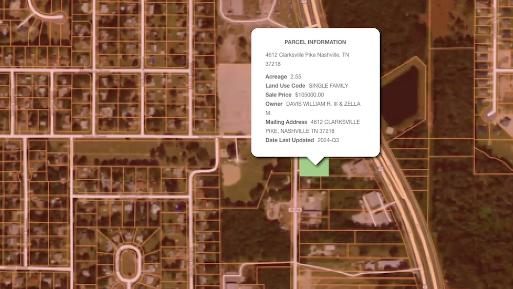
We’ve added Parcel boundaries for any given parcel in the United States. Each parcel comes with boundaries, acreage, land use code, land use class, zoning, transfer date, sales price, and owner information.
To access this layer is simple!
Step 1: Set your trade area
Step 2: Press “Y” on your keyboard to engage the parcel layer
Alternatively: You can press Y on your keyboard or choose “Land Parcels” from the drop-down menu on the filters bar.
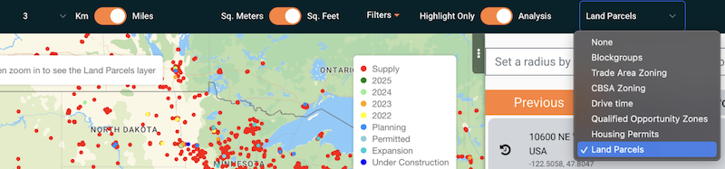
Step 3: Zoom in on your radius to view the parcel boundaries.
Step 4: Click the parcel- and view available information on the parcel you selected!
If you want to upgrade to get parcel data for your account be sure to reach out to a team member and we’ll be off to the races!